 |
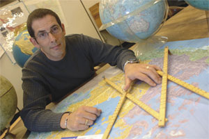
| James Boxall is the director of the GIS Centre. (Danny Abriel photo) |
The next time you’re circling campus admiring parking spaces that others have claimed — and perhaps even tailing people who look like they’re heading toward a parked car — take the time to imagine a different system.
What if the natural ebb and flow of traffic patterns on campus could be tracked, mapped and analyzed? Parking passes could be issued for particular days of the week and times of the day. The expected duration of your stay and the most convenient location for your classes would be anticipated.
Parking is a hypothetical application of Geographic Information Systems, but GIS — as it is more familiarly known — is unlimited in terms of scope according to James Boxall, the Director of the GIS Centre. The GIS centre is a multi-disciplinary research facility situated in the Killam Library, just off the Learning Commons.
“Almost everything in the world has a location. GIS maps those locations and a researcher asks geographic questions, like: What’s the pattern? Why is it there? What do the stats show us about changes? What predictions can be made?” he says.
Unwelcome mumps outbreaks have surfaced on campus and throughout the province recently. “We know how mumps is transmitted, but where and for what reasons? We’re mapping where outbreaks occurred to see if we can identify hot spots and patterns over time,” he says. Whether the topic is mumps, obesity or type-2 diabetes, epidemiology is one of the fastest growing applications for GIS techniques.
“The key thing is if the question can be related to geography,” he adds. What impact does agricultural pollution have on groundwater quality? What can be predicted about the movement of people to refugee camps in Afghanistan and Pakistan? How do animals migrate through natural habitats? Where is an arsonist likely to strike again? What are the optimal strategies during a crisis simulation?
Most fascinating to him personally was a project on the History of the Book. In collaboration with researchers Bertram MacDonald and Fiona Black, GIS was used to map the 19th century book trade in Canada.
Maps present the results in an easily accessible format. There are numerous designs, ranging from street maps to topographic maps or maps of environmental hot spots. The centre has generated 3D maps of historic sites, including Halifax’s Citadel Hill, and of proposed architectural designs, such as downtown’s Twisted Sisters towers.
Along with the director, there are three other staff members and generally about half a dozen graduate students working in the centre. The graduate students are from different disciplines, often chosen due to the subject of the research. Initially, they’re not usually GIS experts, but have strong backgrounds in statistics and excellent analytic and spatial abilities.
Dalhousie’s centre offers the most diverse capacity in a Canadian university. Throughout the university, many faculties have obtained the software and are actively engaged with GIS applications.
“If you consider the multi-disciplinary aspects, it would make us the biggest in the country,” says Mr. Boxall, who is currently the President of the Canadian Cartographic Association. “This is the best job in the world for a geographer.”
They’ve even put together an interpretation of the appearance of the island in Lord of the Flies, based on the geography of an actual South Pacific Island, matched against descriptions culled from William Golding’s famous allegorical novel.
Seems like the only boundaries are your imagination.
Points of reference
|
