")
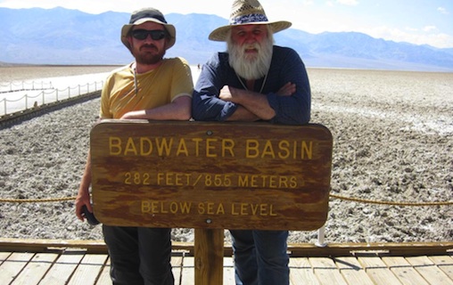
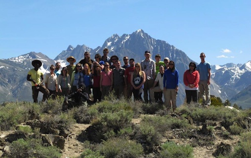
Unlike the prospectors bound for California’s gold fields in 1849, Dalhousie’s senior Earth Sciences students were not lost when they arrived in Death Valley early this May.
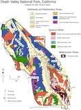
Camping in four different locations — the Mormon Mountains in Nevada, Death Valley National Park, Panamint Valley, and the White Mountains in California — the group of 21 students, three teaching assistants, two directors, two Nunavut Arctic College students, and one camp manager braved remarkable locations over the course of nearly a month for a one-of-a-kind field school.
“Experiential learning is our focus,” says co-director Mike Young. “This is our big adventure for the students.”
This field school, unique in Canada, had previously been set up as a field trip and geo-tourism course, where senior students would travel to very exotic places every year. They only lasted 10 or 12 days, though, and it was common for students to stay in motels rather than camp.
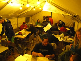
“We wanted a longer experience to mimic the professional world for our students, whether it is academic, government or, more likely, industry,” says Young. “Half of our goal with this field school was mimicking that camp life, that building of a community to achieve a common goal.”
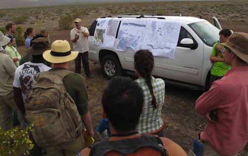
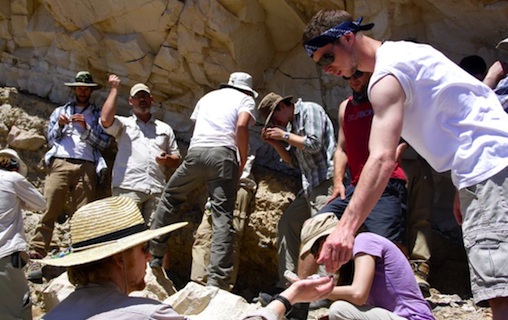
The team of students and staff completed intensive and rigorous mapping projects, reports and field work, all the while growing accustomed to managing camp life — from cooking to cleaning to making sure the camp was running efficiently.
“It’s kind of how you would live up North when working,” says student Rachel Milligan. “These are the only people you are going to see for a month and you have to work together.”
The field school was focused on four major themes: regional stratigraphy, the idea of looking at geology through time; compressional tectonics, the study of mountain building events; extensional tectonics, the development of big valleys such as Death Valley; and strike slip tectonics, such as the San Andreas Fault.
“We got to take everything we did up to now in school and actually see it and apply it,” says student Taylor Campbell.
Locations that give the best examples
Co-directors Mike Young and John Gosse were able to take advantage of the length, the location and the climate of the field school to provide the very best geological examples for the students.
“The weather is so dry that we could make a plan and stick with it. We could work every day and never have to delay a project because of rain,” says Young.
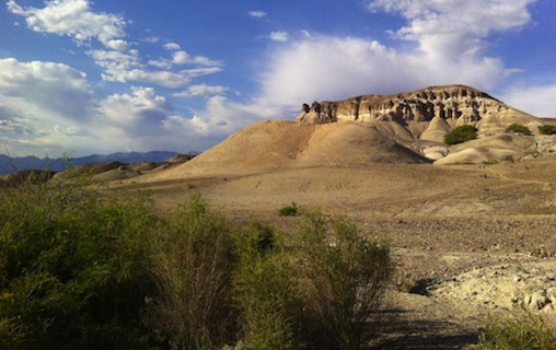
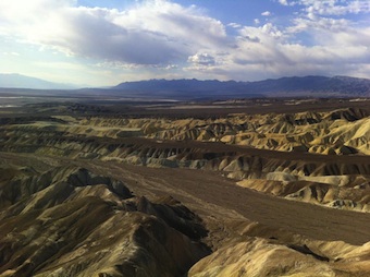
In Nova Scotia and much of Canada, accessing great geological examples is much more challenging, since trees, grass, or soil cover 90 per cent of the rock outcrop. Geologists often have to hike along rivers or coasts to find exposed rock surfaces. Weather also usually plays a factor in Canada. This was not the case in California, Death Valley and Nevada, as the field school worked in areas that had nearly 100 per cent exposure in every area.
 “Exposure was important for us,” says Milligan. “The whole tectonic history and stratigraphy, the layers of rock, and the history of how they were deposited and why it is so easily seen are available in areas of great exposure like Death Valley.”
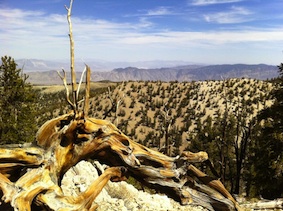
“Another thing we don’t have in most of Canada is active tectonics,” says co-director Dr. Gosse. “The students actually stood on faults that ruptured within centuries—they stood in areas that are actively seismic.”
“It’s unfortunate that we didn’t feel an earthquake,” says Campbell. “But if we'd had seismometers with us, we would have measured 2 and 3 magnitude earthquakes all around us.”
On one of the last days of the field school, the students even stood on a 600-year-old volcano with magma that had come near the surface in 1984.
“Now the students know the story of the other side of the continent and now they can compare and contrast how continents evolve through time,” says Young.
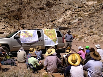
The importance of mapping
 The mapping projects were designed to give students an appreciation of how much work goes into making a geological map.
“With making a map comes interpretation,” says Dr. Gosse. “The students had to ask themselves what caused what they are seeing… they had to look for smoking guns. They had to look for a relationship that would allow them to rule out one hypothesis over another and that’s what they did multiple times every day for each project.”
A geological map is much more complicated than your regular road map. All sub-fields of geology rely on the very basic and complicated information portrayed in a map sheet such as geological features including faults, folds, foliation and lineation. They are shown with symbols that convey the often complicated three-dimensional geometry of the various rocks in the area. Even rock units and strata are shown by color or symbols to indicate where they are exposed at the surface.
 “Some students may never map again and do fieldwork, but they will have this experience under their belt,” says Young. “They will now have the confidence to do something as challenging as this field school. I think it will set our students apart for the future.”
A spectacular experience
Both students agree that this field school was an amazing experience.
“Mike and John are so passionate about what they do and they give you the motivation to want to be like that,” says Campbell.
Special thanks
The Department of Earth Science wanted to express their thanks to the sponsors who made this new one-of-a-kind field school possible through their generous support.
Sponsors:
Canada Nunavut Geoscience Office (CNGO), Shell Canada, Acadian Mining, Prosperity Goldfields, Imperial Metals Corp, Prospectors Developers Association of Canada (PDAC), Canadian Society of Exploration Geophysicists (CSEG), Geological Association of Canada (GAC), and the Dal Science Society (DSS).
Special thanks to the Canada Nunavut Geoscience Office (CNGO) who provided funding for the camp manager. CNGO also sponsored Patricia Peyton and Candice Sudlovenick, two students from the Environmental Technician Program at the Nunavut Arctic College in Iqaluit, (shown in the CBC video at 40:20 and a Nunatsiaq News story), amounting to $16,000.