
")
It’s home to the highest points on planet earth, but until recently, there were aspects of the Himalayan mountain ranges that geologists simply could not explain.
In particular, scientists were uncertain just how, exactly, the mountains formed. The most common argument was that they were entirely the result of India’s land mass moving into Asia. But new Dal research suggests a different answer, buried deep within a complex fault system in western Nepal.
“It’s going to change the way geologists are thinking about this,” says Earth Sciences’ John Gosse. “Geodynamicists studying the world’s biggest and most iconic mountain range will probably need to incorporate this going forward.”
Dr. Gosse teamed up with fellow Dal researchers David Whipp and Chris Beaumont (both in Oceanography) on “Limit of Strain Partitioning in the Himalayas Marked By Large Earthquakes in Western Nepal,” published in the recent edition of Nature Geoscience (the other coauthors were Michael Murphy, Michael Taylor and C.R.P. Silver). It is the first study of is kind to investigate this particular fault system.
The compression of the Indian plate and Asian plate as they press together was believed to be responsible for the high peaks throughout the entire range, from China to Pakistan. However, this new fault line shows that the two plates are also moving sideways, pulling apart in the area of the new fault.
“Because the plate boundary is curved, we’re getting a side-by-side motion away from the centre of the range front,” says Dr. Gosse. “Now we have to modify the way we believe the Himalayas are actually forming.”
From Google Earth to mountain hikes
Interestingly, the fault was first discovered digitally: Michael Taylor of the University of Kansas noticed the fault when virtually touring the area on Google Earth and quickly called on expertise of Dr. Gosse and the other researchers.
“Before we had Google Earth, we would have needed to get photos from the Nepal government, for example, and it could’ve taken a long time and lots of money,” says Dr. Gosse. “This beautiful, big fault was immediately apparent, just absolutely gorgeous from a geologist perspective. Rather than wait for a proposal, we figured, ‘Let’s just get going on this.’ We scraped some money up and got an expedition team together as fast as we could.”
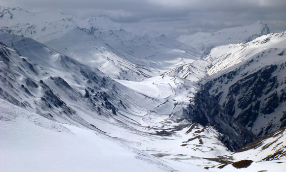
Flying into northwestern Nepal and hiking more than 40 km of the fault system by foot, much above 5000 m elevation, the field team worked to map, measure and collect radiocarbon samples to date the fault.
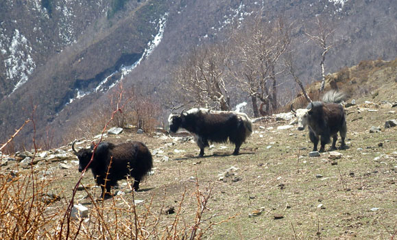
“As soon as we got to the High Himalayas, you really realize the scale of the mountains,” says Dr. Gosse. “The expedition took us 40 km along a river side path that paralleled the fault, then high up over some of the Earth’s highest topography. We passed above remote temples and pristine caves and gorges that were rarely visited by foreigners.”
Modeling a safer future
A numerical model created by Drs. Beaumont and Whipp at Dal shows that in fact, the fault is incredibly significant. “It would be difficult to convince anyone of the significance by just doing field work to document a fault; there are lots of faults all over the world,” explains Dr. Gosse, who teaches Dal’s course on natural disasters. “The model can now explain features that could never be explained before now. We just had to ask the right question.”
The fault not only may be the source of the devastating earthquakes in the area 500 to 600 years ago, but suggests the potential risk of another one today.
Prior to the study, the area was not identified as at risk for large earthquakes greater than Magnitude-8. Equipped with this knowledge, Dr. Gosse and the other researchers hope to continue to study the fault system, to map the rest of the more than 200 km length, to understand future risks.
“You’d like to think that you’re going to help someone who is in charge of coming up with building codes for a local city,” says Gosse. “We’re trying to explain how the earth works, but in a very useful way that could actually save lives in the future.”
Sharing this fault system discovery with many in the scientific community for the first time, Gosse will give a presentation at the next Atlantic Geoscience Society meeting in Wolfville.
“Not many projects you do in your career are on the biggest or best example, but finding something really new about the Himalayas which have been studied for over a century and coming up with something new with significance — you often don’t get a chance like that.”