
 |
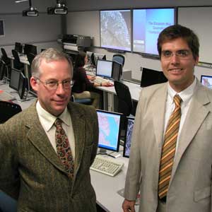
Professors Charles Walls and Daniel Rainham (Dominioni photo) |
The centre is equipped with a number of dual-screen workstations and Geographic Information Systems (GIS) software, ergonomic chairs, specialized SMARTboard teaching screens and dimmable computer lab lighting. The walls of the new computer lab are adorned with maps and satellite views of Nova Scotia and Canada.
ÒMany students come in with no prior knowledge of GIS at all,” said Daniel Rainham, an environmental science instructor using the new teaching facility. ÒMany of them are coming from Arts and Social Sciences programs. TheyÕre introduced to GIS in their first lab session and by the end of it, theyÕre performing some fairly complicated tasks.”
The renovation of the former biology wetlab was a joint effort by the departments of Earth Sciences and Environmental Programs, with support from an anonymous donor and the Elizabeth May Chair in Sustainability and Environmental Health. Mapping also has many useful applications for students in sociology, history, management, planning, computer science and even religious studies, remarked Keith Taylor, Dean of Science, during the ribbon-cutting ceremony. The event took place on November 8 as part of DalhousieÕs third annual Environmental Research Symposium.
The emergence of GIS technology allows researchers to combine and analyze an incredible range of data, and itÕs playing an increasing role in many careers, said Dr. Taylor, adding ÒI donÕt know that even 15 years ago, if people realized how significant it would be.”
Demonstrating the new equipment, earth sciences professor Charles Walls agreed the technologyÕs evolution is allowing researchers of all stripes to Ògenerate answers that were never even possible before.” Rainham uses GIS extensively in his own research, including his ongoing Halifax Healthscapes study. It tracks movement patterns of individuals throughout the Halifax area, to investigate their exposure to environmental contaminants such as air pollution.
ThereÕs no limit to the kind of study that can benefit from GIS, said Rainham, who is finding it especially useful for topics involving human health and environmental sustainability. ÒProbably more than 90 per cent of information has a spatial or location component that can be displayed visually on a GIS,” he said.